")
Hiking route
LONG HIKING TRACKS
Our area has the particularity of being crossed by several important long hiking tracks (called “GR”): GR9, GR559, GR5 and GR “de Pays Tour de la Haute Bienne”.
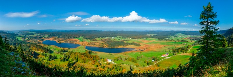
GR9: Going from “Saint Amour” in the Jura to “Port Grimaud” in the Var, it crosses the valley of “La Bienne” to reach the village of “Longchaumois”. You will be pleased to cross the river on the Bridge of Longchaumois and then head up to the village by making a detour by the panoramic viewpoint of “La Corbière”. Then a long but smooth path is going uphill to reach Rosset and enjoy many panoramic views. You will finally get into the forest to walk on the comb of “Mont Fier” before the arrival at “Prémanon”.
There is the possibility to make a stop at the “Gîte de Rosset” (for a group of 20 persons) on your way.
GR59: This track is crossing the Jura from West to East, starting from “Montaigu” and ending at “Les Rousses”. This is a 95km long track from the Jura plains to the Haut Jura, passing through the lakes area and the “Hérisson” waterfalls.
You will enter our area from “Le Lac de l’Abbaye” and by crossing the “Forêt de Joux Devant” (Joux Devant forest) to reach “Tancua”, then you will cross the river “La Bienne” and go uphill to “La Mouille”. Afterwards, you will be into a forest “Le Bois du Bévet” that will lead you to “La Doye” situated at the exit of “Morez” before the final ascension towards “Les Rousses”.
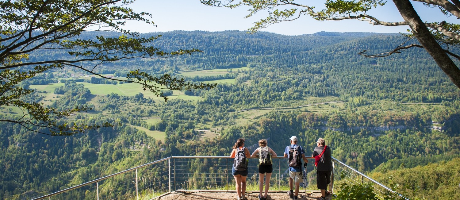
You have the possibility to eat in the village of “La Mouille” in the restaurant “L’Auberge des Forgerons” or in “Morez” if you leave the GR59 and take the GR “du Pays du Tour de la Haute-Bienne” before you arrive to “Le Béchet”. This path is remarkable thanks to its 3 successive panoramic viewpoints: “Le Rocher du Béchet”, “La Roche Fendue” and “La Roche au Dade”.
GR “du Pays du Tour de la Haute-Bienne”: This GR is an approximately 100km loop starting and ending in “Saint Claude”. Starting from “Cinquétral”, you arrive in “Longchaumois” via the very nice comb of “Servagnat” and then go on towards “La Mouille” via the comb of “Les Adrets”. You will enjoy successive panoramic viewpoints before reaching “Morez” and then going directly uphill towards “Morbier” and finally “Bellefontaine”.
You have many possibilities to eat, have a break or even spend a night in: “La Mouille”, “Morez”, “Morbier” and “Bellefontaine”.
GR5: This track is a European Long Hiking track (E2) which starts in the Netherlands (on the beaches of the north sea) and ends 2500km further in “Nice”, France, and its beautiful beaches of the Mediterranean Sea. The arrival in our area is from the “Doubs département” to reach the panoramic viewpoint of “La Roche Bernard” in Bellefontaine before entering deeply into the “Risoux” forest all the way to “Les Rousses”.
You have the possibility to eat and sleep in the “Gîte chez L’Aimé” on your way or in the village of Bellefontaine if you take another GR (“Pays du Tour de la Haute-Bienne) on approximately 2km.
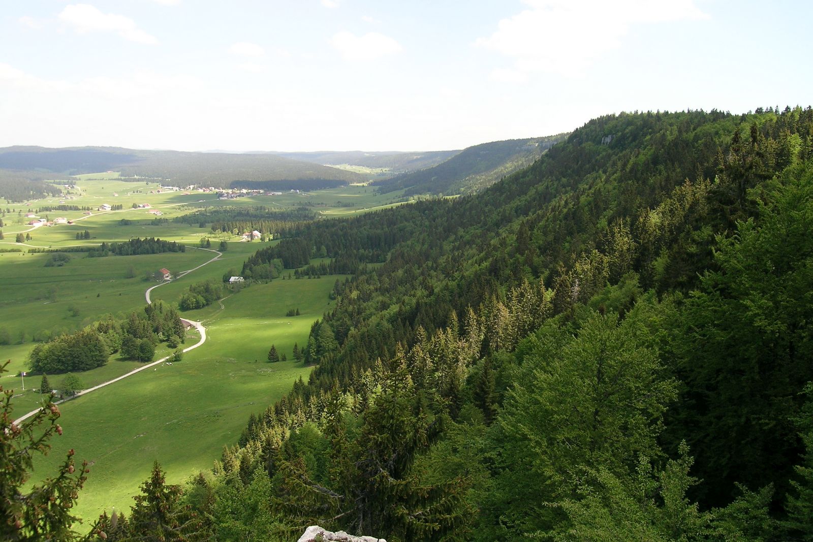
Les Grandes Traversées du Jura (Long Crossing of the Jura): This hiking track goes along the Jura Mountains from “Mandeure” (near “Montbéliard”) to “Culoz” (in the “Ain département”). Starting at “Chapelle-des-Bois”, it runs along the wonderful site of “Les Mortes” and “Bellefontaine” lakes until you reach the village of “Bellefontaine” and then you cross the forest to go to “Les Rousses”.
Possibility of catering and housing on your way, in the “Gîte chez L’Aimé” or at “La Chaumière” or “L’Epicéa” in Bellefontaine.
L’Echapée Jurassienne: this 260km track of hiking crosses the Jura from North (“Dole”) to south (“Les Rousses”), with the possibility to join “Saint Claude”, which promises great discoveries! You can make this experiment at your own pace, from 2 to 13 days! A luggage carry service is open from June 15th to September 15th. You can find a great choice of housing on their website.